The city of Salta in the northwest of Argentina was my base for a 6 day, 550 km round trip to Valle Lerma, Cafayete, Valles Calchaquies, Cachi and back to Salta over the 3457 m pass Piedra del Molino. Salta itself is full of nice old colonial buildings dating from the mid-1700's, plenty of green spaces, and at 1200 m in altitude it has
a pleasant climate at this time of year (mid-April). I've also had my first taste of Inca culture here. In anticipation of a good harvest in the coming year, the Incas would bury children as human sacrifices on the tops of some of the highest mountains in the district. The frozen, mummified remains of 3 Incan children were dug up from the summit of nearby Cerro Llullaillaco and put on display in Salta's Museo de Arqueologia de Alto Montana. It's only a small exhibition but very powerful.
I headed south on Ruta 68 to Cafayete passing through Valle Lerma. After the town of Alemania (I could see no resemblance with anything German), the valley narrows into a gorge, the Quebrada de las Conchas, with many fascinating red-tinged rock formations. Candelabra cacti started making an appearance, and I felt like I was suddenly riding through the set of a cowboy movie.
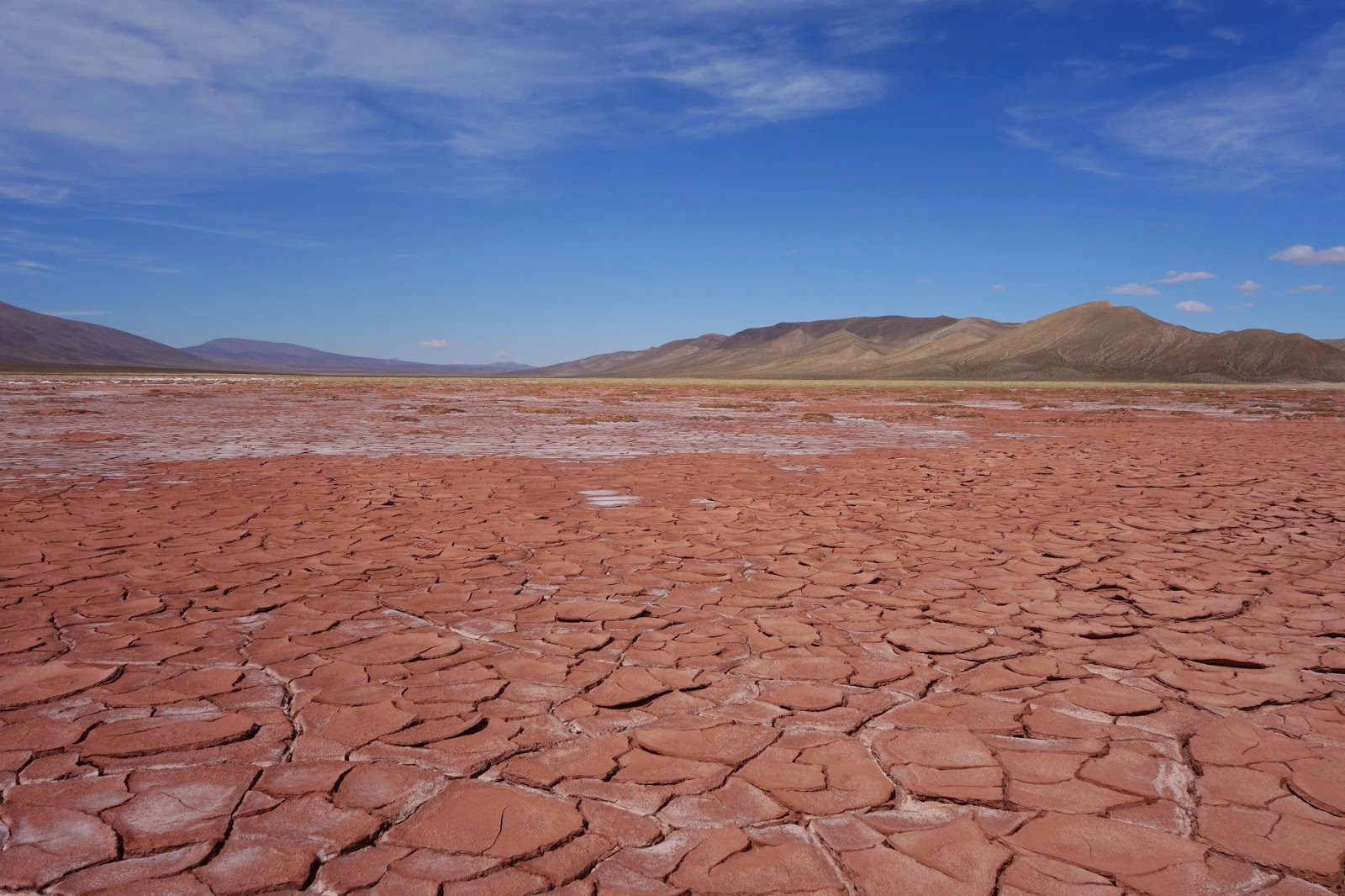
The nice little town of Cafayete was my southernmost point in the loop and from here I headed north towards Cachi on Ruta 40 (incidentally I also rode part of this road some 4500 km south in Patagonia). Ten kilometres outside of Cafayete, I had my first run-in with thorns - while leaving the road to take a photo I managed to get 3 punctures at once, leaving both tyres flat and forcing me to hitchhike back to Cafayete for a visit to the gomeria. Two hours later and much the wiser (stay on the road!) I was on my way again. Leaving the irrigated wine-growing region around Cafayete behind, the rough gravel road passed through the Quebrada de los Flechas, a semi-arid region of rocky outcrops, then followed the braided rivers of the Valles Calchaquies to the village of Seclantas. At Seclantas I made a detour to Laguna Brealito and got my first glimpse of 6720 m Nevado de Cachi.
Along the way, it was always fun to ask the locals for supplies of water, empanadas, grapes or freshly baked bread and chat to them a little bit in my dodgy Spanish. It was also the season to dry pimientos (ground up to make cayenne pepper) and in many places they were laid out to dry in the sun like big red carpets.
After a night in Cachi, I set off to climb over the 3457 m pass Piedra del Molino. With the massive Nevado de Cachi at my back, I rode upwards through a barren landscape of high-altitude pampa dotted with thousands of candelabra cacti to the cold, foggy and windswept pass. The seemingly endless 2200 m descent took me into the humid and thickly forested valley on the other side. It started to rain so I called it a day in El Carril, hit the nearest restaurant for a milanesa napolitana and fries and slept like a baby.
I'm now back in Salta for rest day, making plans for heading north to Humahuaca, Iruya, Paso Jama and San Pedro de Atacama in Chile.
One of the many nice churches in Salta.
A view from the inside.
Monument in Salta's main square, Plaza 9 de Julio.
Ruta 68 south of Salta passes through numerous small towns in the Valle Lerma. Here are some junior gauchos in Coronel Moldes.
Beat-up old cars are a common sight - Ford seems to be the most popular.
Following the Rio de las Conchas into the gorge south of Alemania.
The amphitheater in the Quebrada de las Conchas.
Intense colours in the Quebrada de las Conchas.
The best way to see this is to ride through it on a bike!!
On Ruta 40 after Cafayete, the landscape gets noticeably drier, although areas around watercourses remain green.
Impressive cliffs by Rio Calchaquies.
Looking back the way I rode through the Quebrada de las Flechas.
Simple adobe housing is the norm in these parts.
Shortly before arriving in Seclantas I passed a couple of cacti having an animated chat.
The way up to Laguna Brealito took me past a kind of semi-arid paradise.
The laguna is famous locally for its mirror effect.
Approaching Cachi, the valley is irrigated and fertile.
Fresh bread from the oven.
Flocks of lorikeets were a common sight near the road.
Drying
pimiento in the sun.
A look back at 6720 m Nevado de Cachi as I headed up to the Piedra del Molino.
I was careful not to take the shortcut!
A lot more rainfall on this side with alpine pastures up high...
...and densely forested valleys lower down.
My route. I started in Salta at top right and travelled around clock-wise. Seclantas in the west was the starting point for the detour to Laguna Brealito.